Monitoring of Erosion, Scour and All-Weather Precipitation
Built in the USA Since 1975
24/7 Cloud Server Software
ETI offers Software as a Service for the turn-key collection, management, display and alarm notification of all the monitoring techniques offered. Regardless of the technique used, the software will provide automated notification on a 24/7 basis to alert responsible bridge safety personnel.

Bridges
Individual bridges are displayed on a map layer of the United States. Various map backgrounds are available including satellite and street views. Clicking on a bridge marker displays a dashboard showing real-time data for each sensor installed at the bridge.
USGS Stations
Existing monitoring stations operated by the USGS or State Division of Water Resources can be included.
FEMA Floodplains
Local floodplain boundaries are included from FEMA.
Radar Rainfall
Radar rainfall displays including animated movement of storms.
NWS Weather Watches and Statements
NWS issued weather statments are included including the warning polygons and exact NWS-issued statement.
Bridge Dashboards
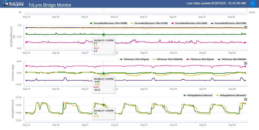
Dashboards for each bridge are available from the map display. The dashboard displays plots of each installed sensor in addition to bridge meta data, photos and alarm thresholds.
